Study Sites for C. carduacea & C. texana in Central Texas
by Bob Harms  email-here
Key to map symbols:
C. carduacea: spring heads with small but visible ligules
C. carduacea: spring heads with reduced and not visible ligules
C. carduacea: very small plants
C. texana

C. carduacea

N. Hays County: over 200 plants, all easily accessible, widely distributed over 50+ acres of previously ranched land on the Purola Preserve and Keyes Ranch, at latitude 30°17'18" N and longitude 98°09'57" W; elevations range from 298 to 335 m. The habitat of the species varies a great deal, including dense Juniperus ashei thickets, shady hardwoods, scattered groves of live oak (Quercus fusiformis), steep creek banks, and open grassland, all on deep calcareous clay soil. Two plants from an open area were moved to pots in spring of 2010.

CHTE7-Purola
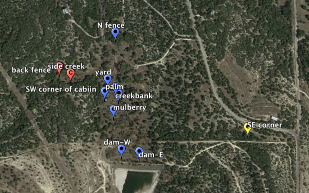
C. carduacea at Purola Preserve

Google Map View

C. texana

Travis County in SW Austin: fewer than 100 plants, 32 easily accessible, on a west-facing hillside with rocky shallow calcareous soil near the mouth of an undeveloped canyon that enters Barton Creek, just west of Zilker Park at latitude 30°15'41" N and longitude 97°46'49" W; elevations ±148 m. The habitat is open juniper-oak woodland with numerous species typical of the eastern Edwards Plateau, many Juniperus ashei having been removed several decades ago. Three plants from this group were moved to pots in spring of 2010. In spring 2011 the threat of wildfires in the area led the landowner to remove all bushes and larger forbs on the hillside, possibly destroying most Chaptalia plants in the process.

CHTE-BCk
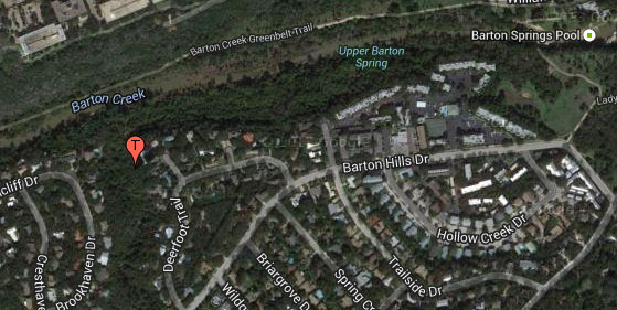
C. texana study population on the Barton Creek Greenbelt, Austin, TX


Plant Resources Center Home PageFlora of TexasChaptalia